


Un portfolio qui témoigne d'excellence et d'innovation
20 projets
 🌾 Agriculture & Land Management
TESSANG FARMING PROJECT
Photogrammetric surveying of 600Ha surface Client : PRIVATE Financing : PRIVATE
 🌾 Agriculture & Land Management
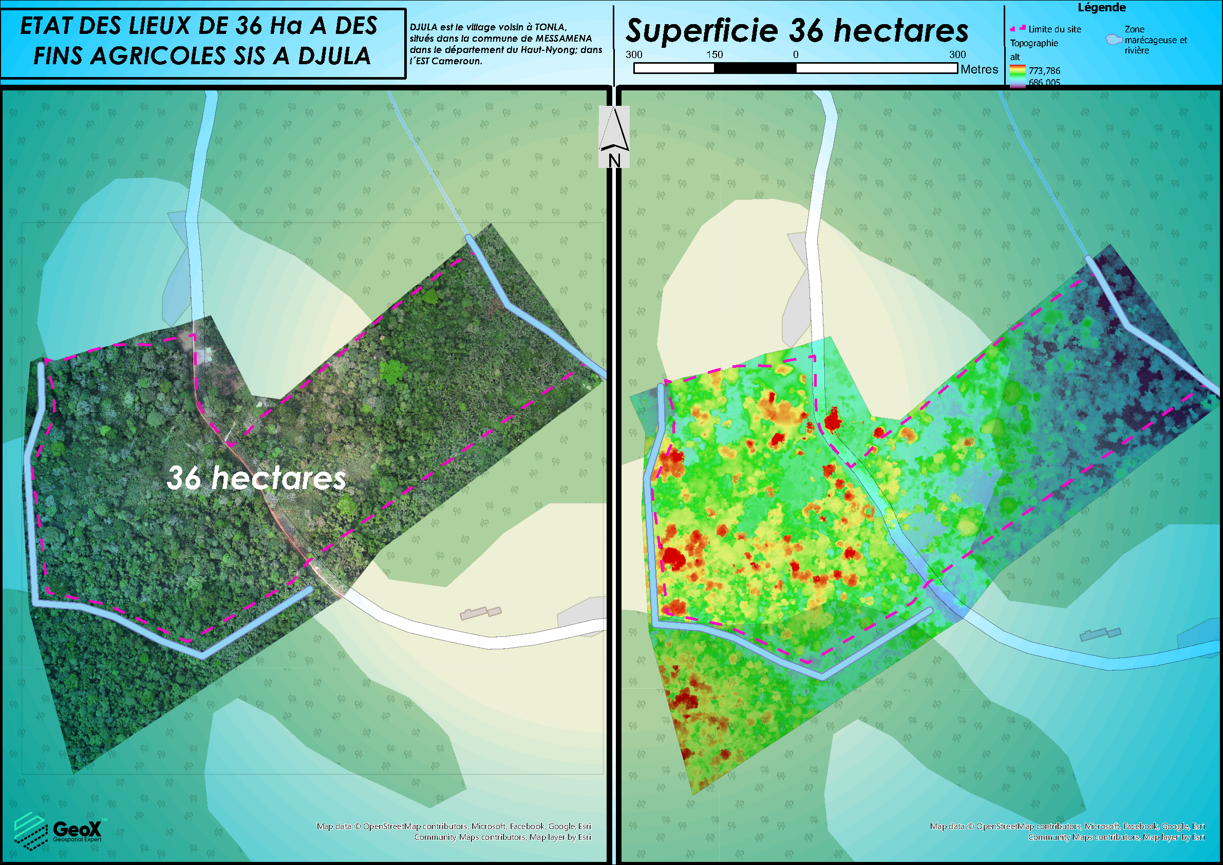
CADASTRAL DELINEATION OF LAND
PHOTOGRAMMETRIC STUDIES OF 300Ha SURFACE
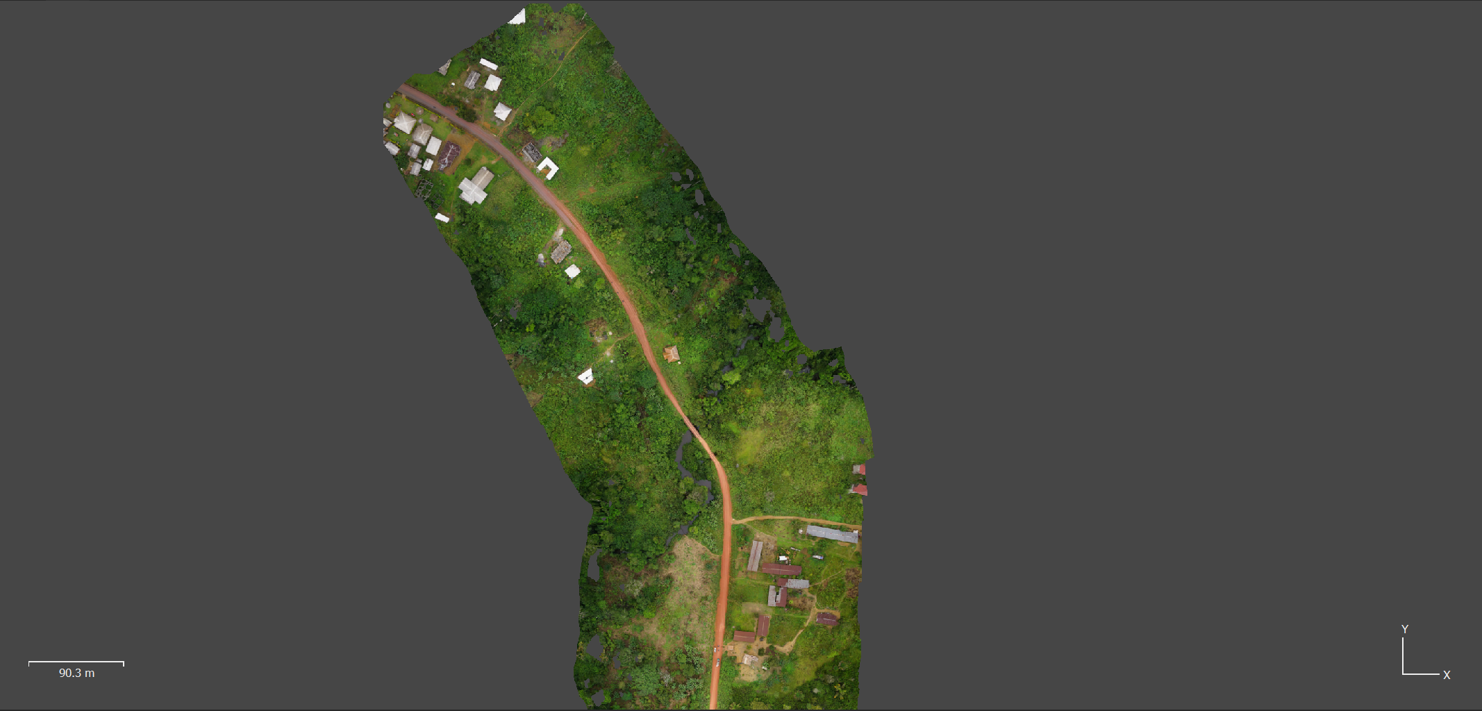
 🛣️ Roads & Highway Infrastructure
CONSTRUCTION KANANGA - TSHIBULU´s ROAD
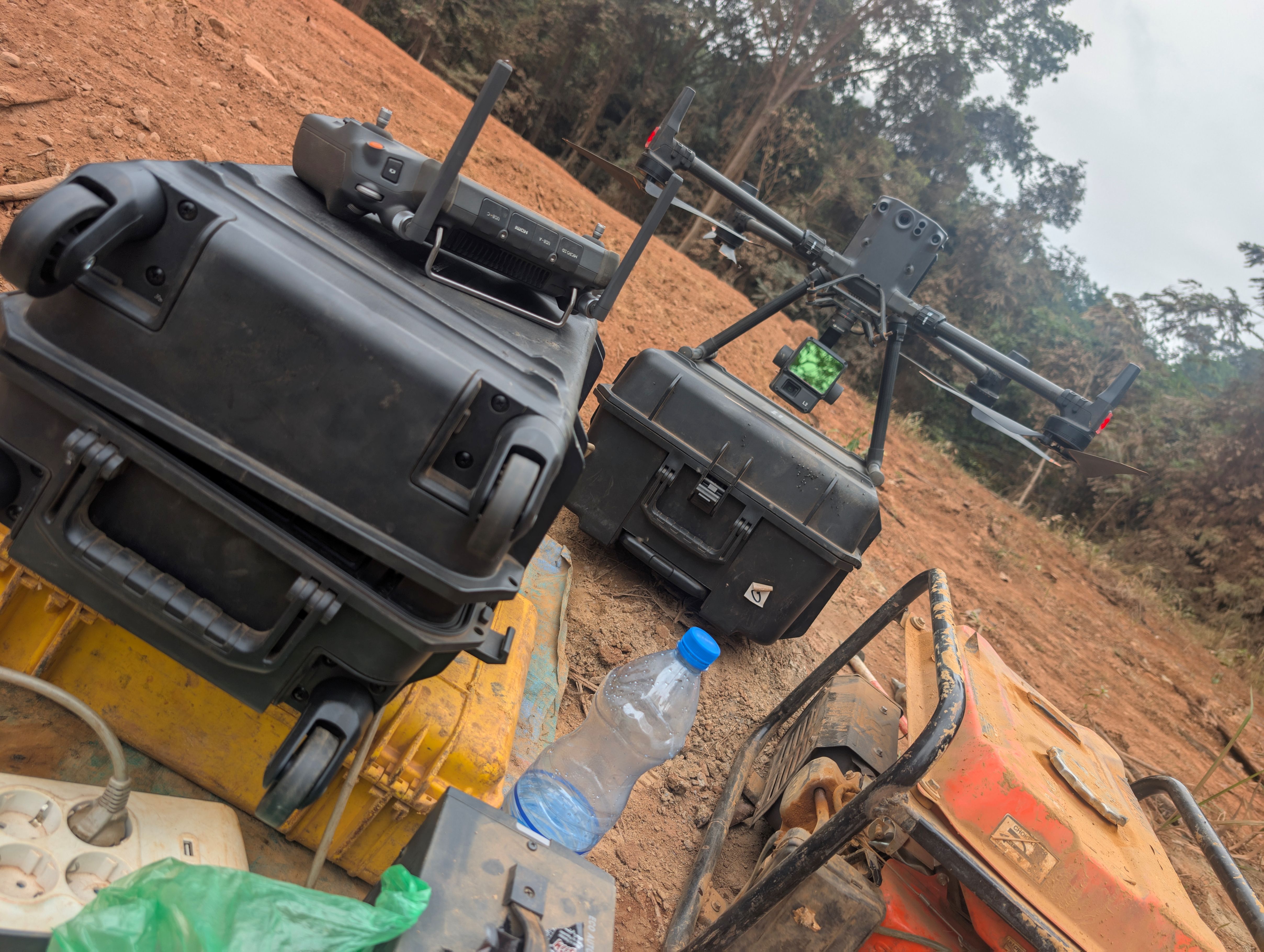
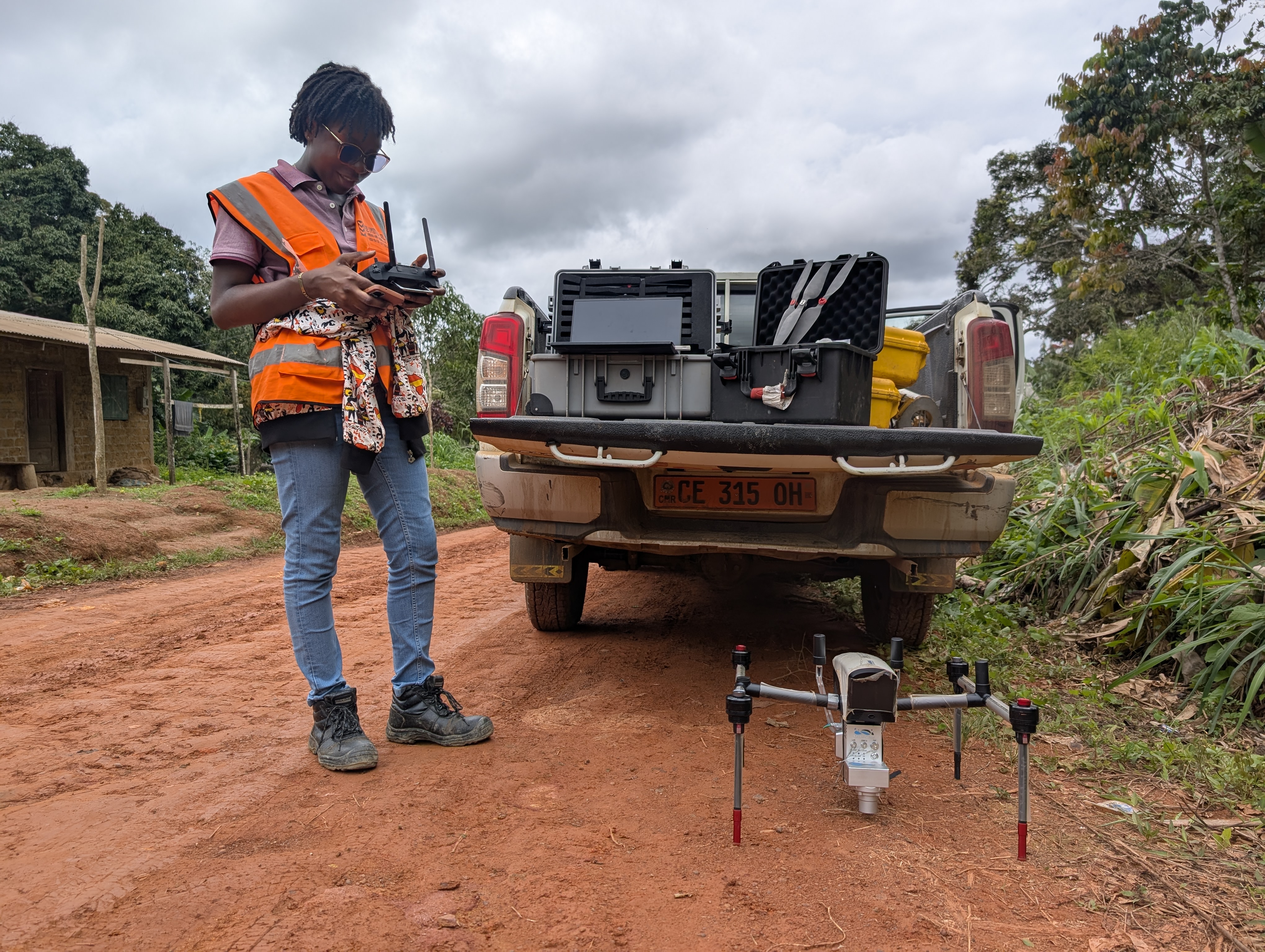
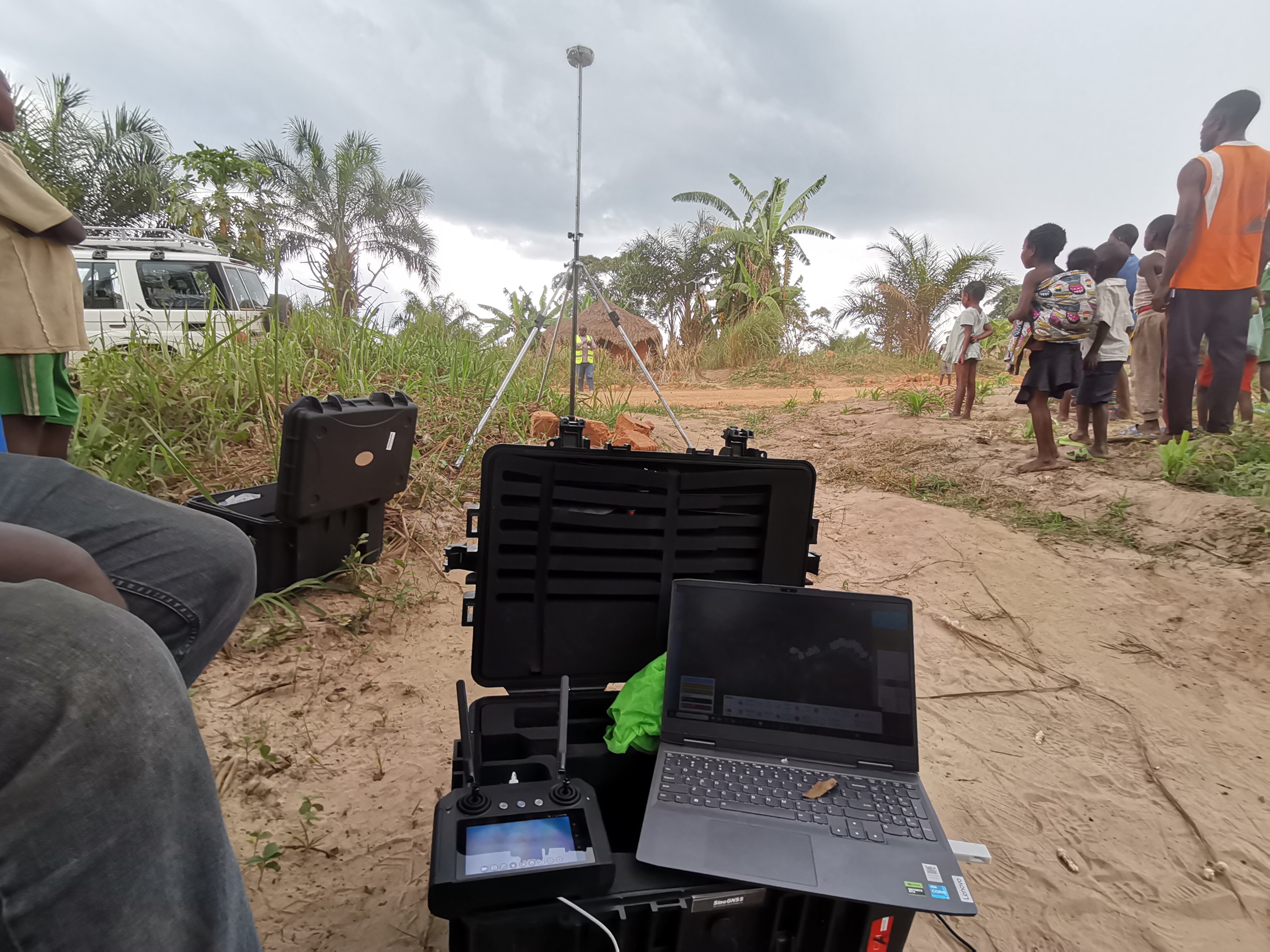
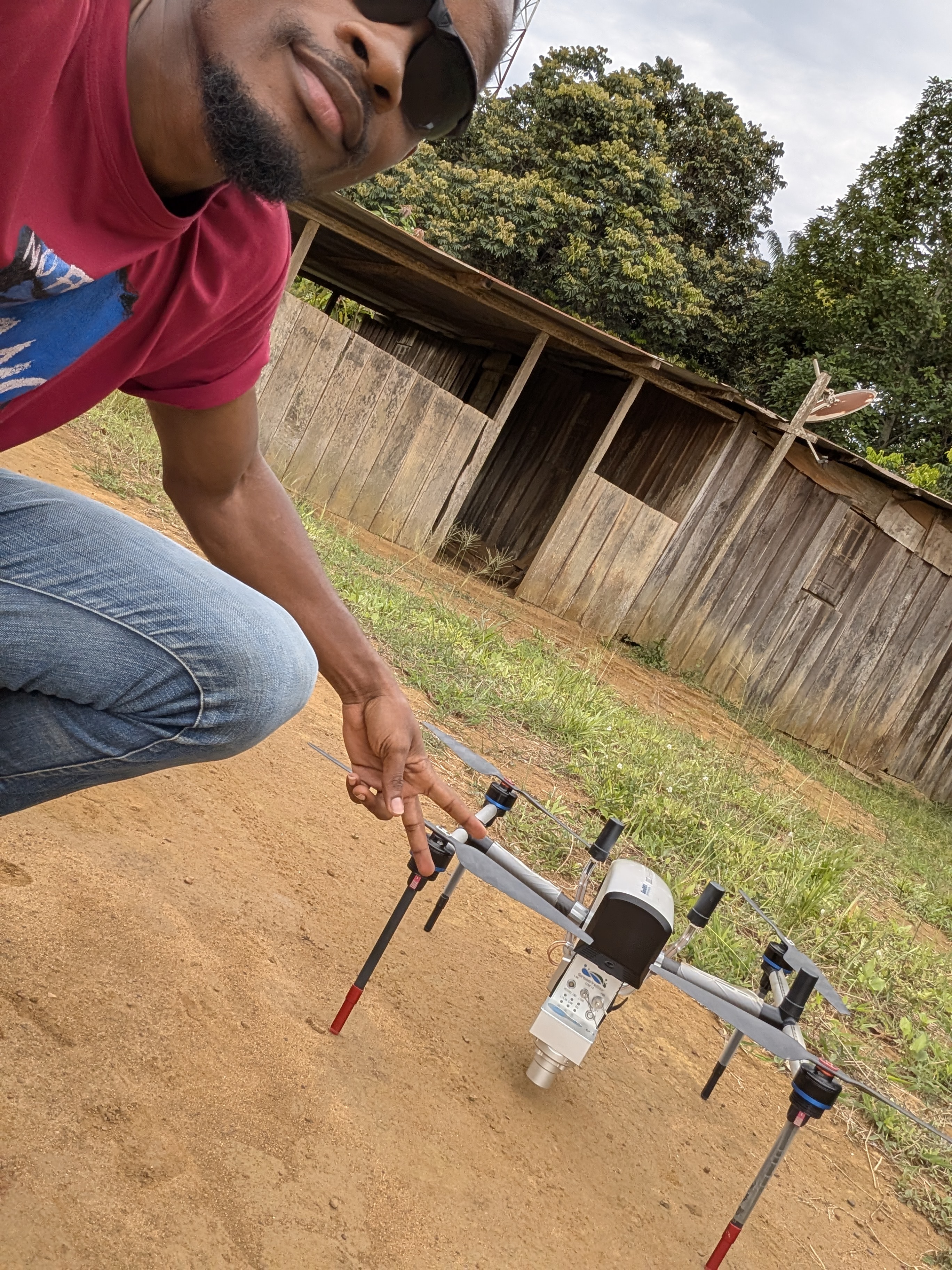
LiDAR AND PHOTOGRAMMETRIC STUDIES OF 175 KM ROAD Client: BKA Financing : • BKA
 🛣️ Roads & Highway Infrastructure
CONSTRUCTION MAKOKOU – OKONDJA´s ROAD
LiDAR AND PHOTOGRAMMETRIC STUDIES OF 260 KM Client: EECSG Financing : • SAGBA BTP
 🛣️ Roads & Highway Infrastructure
CONSTRUCTION ALEMBE – MIKOUYI´s ROAD
PHOTOGRAMMETRIC STUDIES OF 306 KM ROAD Client: EECSG Financing : • PORTEO BTP
 🛣️ Roads & Highway Infrastructure
Construction of Mvangan-Ebolowa´s Road
LiDAR AND PHOTOGRAMMETRIC STUDIES OF 41km road Client: SHEE SYSTEM Financing : • SHEE SYSTEM
 🛣️ Roads & Highway Infrastructure
KAMWANGA - TSIKULA ROAD CONSTRUCTION PROJECT
LiDAR, photogrammetric surveying Client: BKA Financing : BKA
 🛣️ Roads & Highway Infrastructure
YOKADOUMA - MOULOUNDOU – KIKA ROAD CONSTRUCTION PROJECT
LiDAR, photogrammetric processing and digitization Client: SETEC
 🛣️ Roads & Highway Infrastructure
Rehabilitation of Mvengue-Franceville´s road
LiDAR AND PHOTOGRAMMETRIC STUDIES OF 15km road Client: EECSG Financing : • PORTEO BTP • Government of Gabon
 🛣️ Roads & Highway Infrastructure
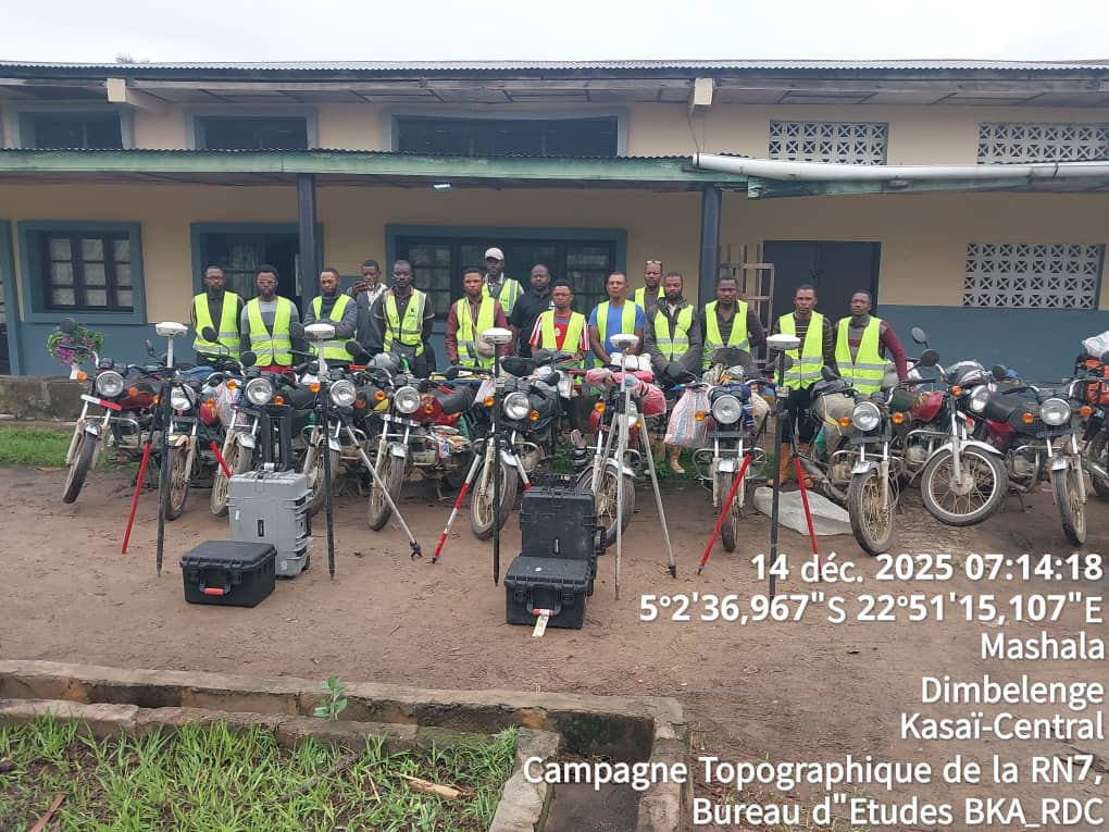
CONSTRUCTION RN7´s ROAD Kananga-Lomela
LiDAR AND PHOTOGRAMMETRIC STUDIES OF 642 KM ROAD Client: BKA / Financing : BKA
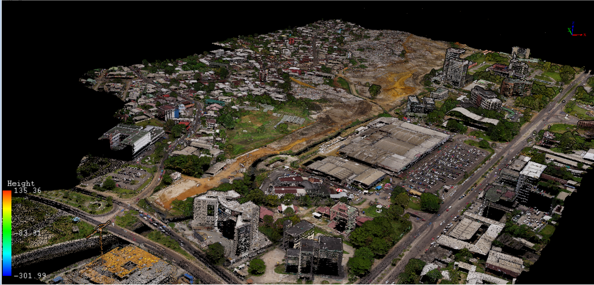
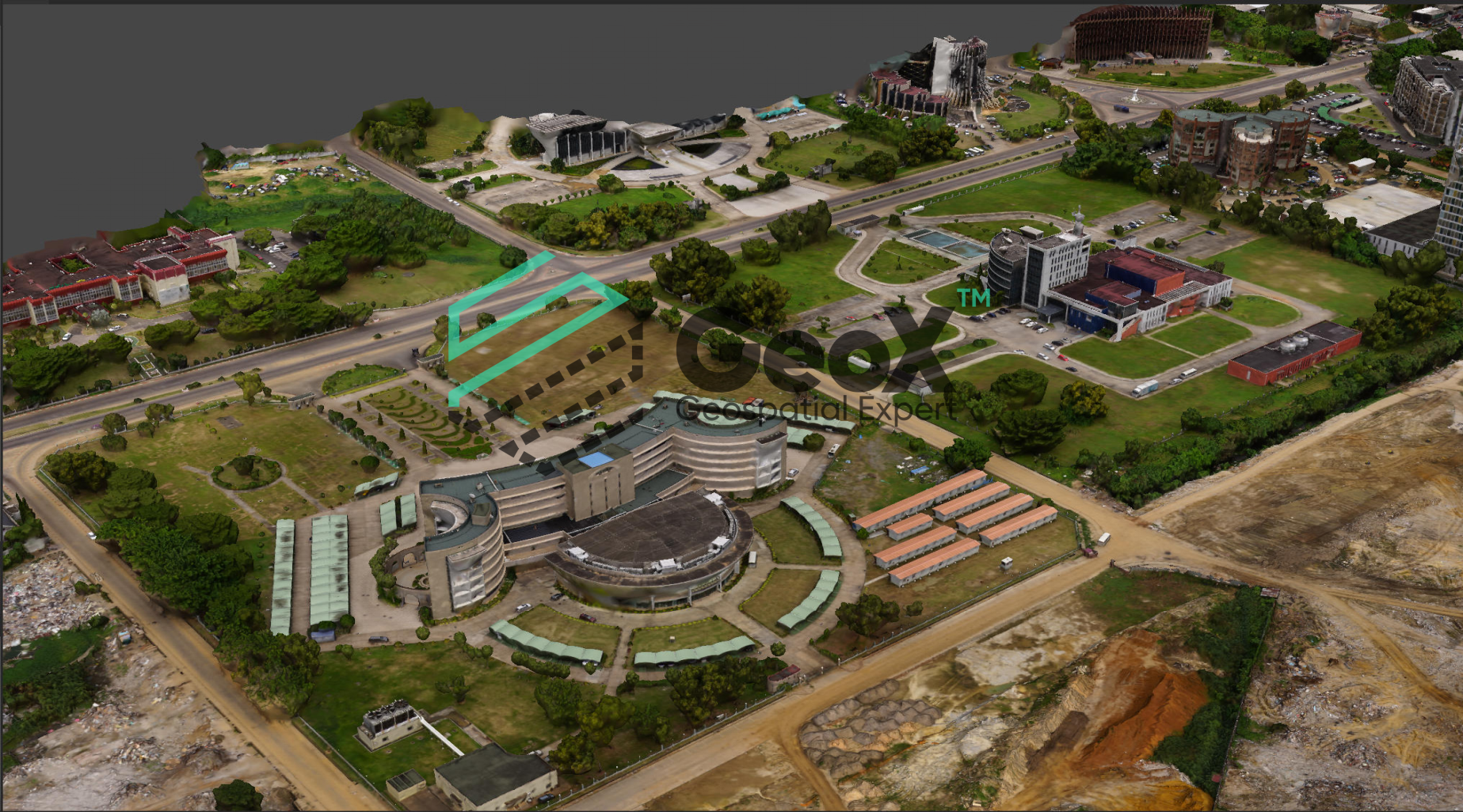
 🏙️ Urban Development & Smart Cities
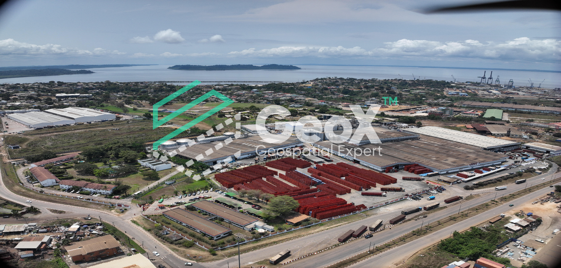
DRY PORT OF NGAOUNDERE CONSTRUCTION
PHOTOGRAMMETRIC STUDIES OF 300Ha SURFACE Client: SIMA Financing : • SIMA
 🏙️ Urban Development & Smart Cities
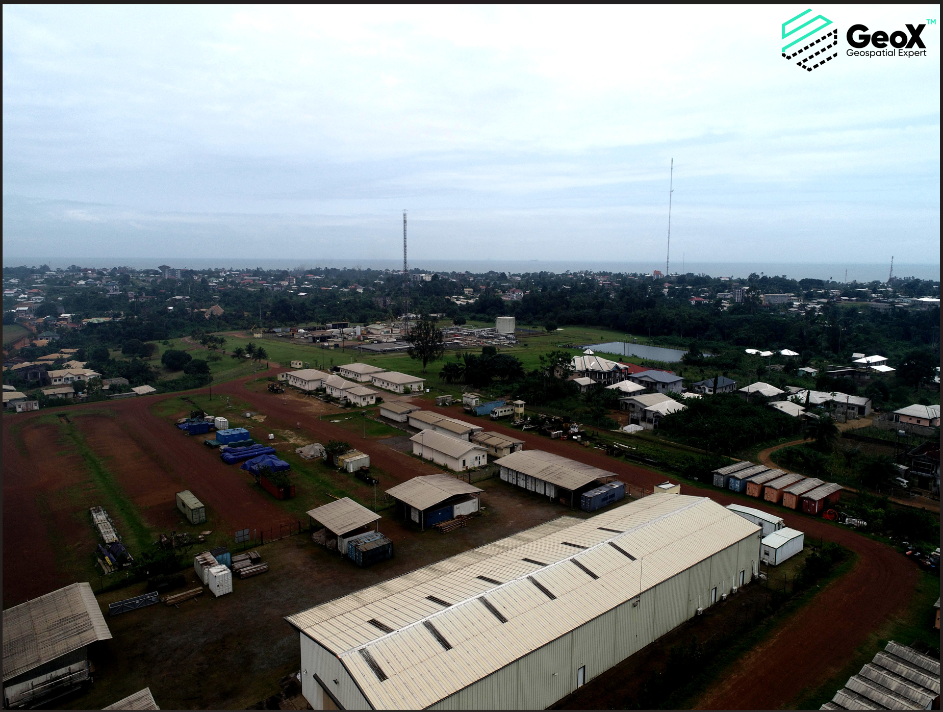
CONSTRUCTION OF NEW NEIGHBORHOOD IN PLAINE ORETY
LiDAR AND PHOTOGRAMMETRIC STUDIES OF 120Ha SURFACE Client: EECSG Financing : • ANUTTC
 🏙️ Urban Development & Smart Cities
DELINEATION OF NEW COTCO SITE
PHOTOGRAMMETRIC STUDIES OF 50ha SURFACE Client: GLOBAL ENG Financing : • COTCO
 🏙️ Urban Development & Smart Cities
Social housing construction in Kango
LiDAR AND PHOTOGRAMMETRIC STUDIES OF 30Ha surface Client: NFTP CONSTRUCTION Financing : Government of Gabon
 🏙️ Urban Development & Smart Cities
Rehabilitation of PetroGabon coast site
LiDAR AND PHOTOGRAMMETRIC STUDIES OF 120Ha surface Client: EECSG Financing : • PetroGABON
 🏙️ Urban Development & Smart Cities
Construction of OLIGUIVILLE
LiDAR AND PHOTOGRAMMETRIC STUDIES OF 2000Ha surface Client: EECSG Financing : • CABINET ARCHITECTURE ATELIER 7 • Government of Gabon
 🚧 Dams & Hydraulic Infrastructure
LOM PANGAR DAM MONITORING
Dam displacement surveying
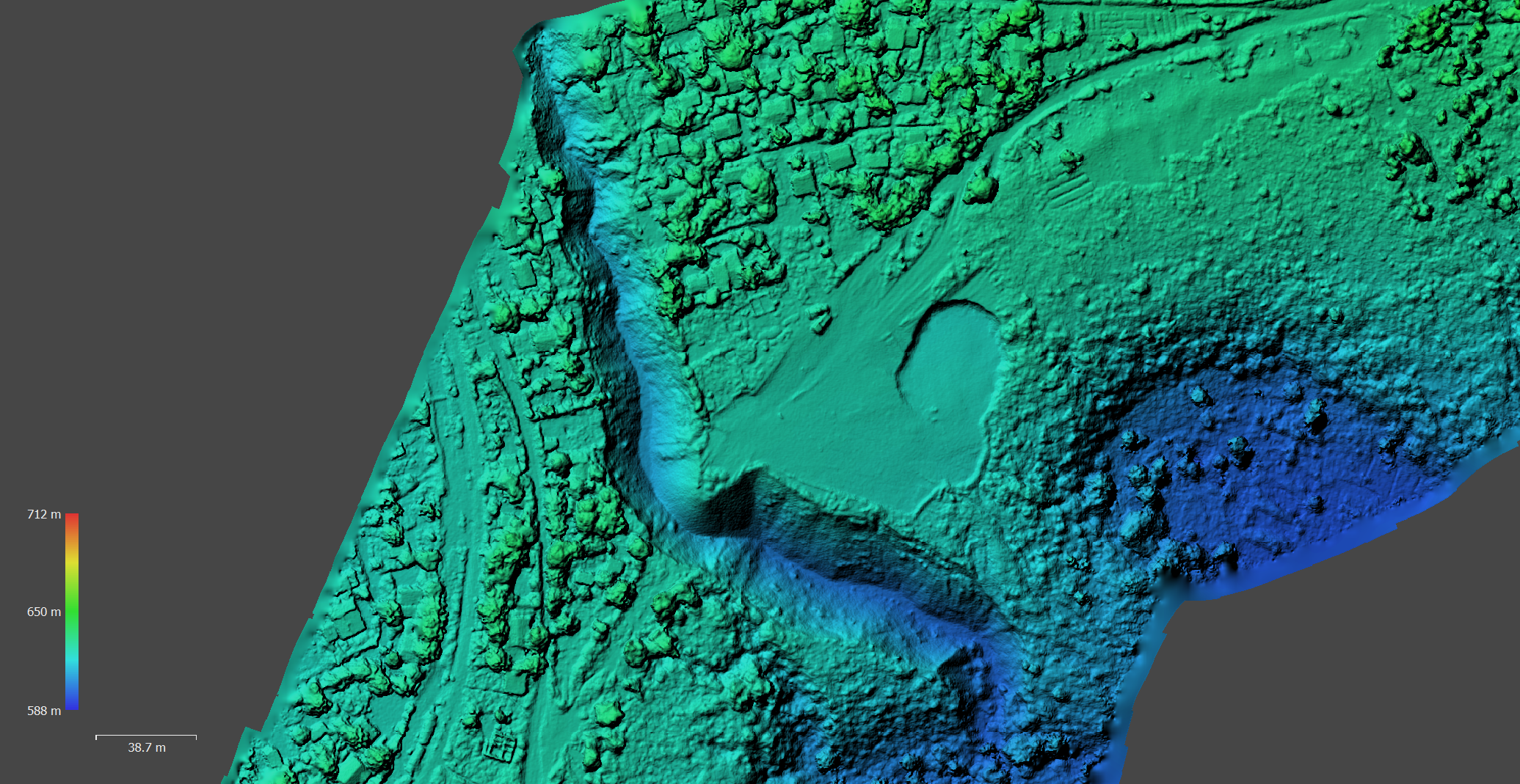 🌪️ Natural Hazards & Disaster Risk Management
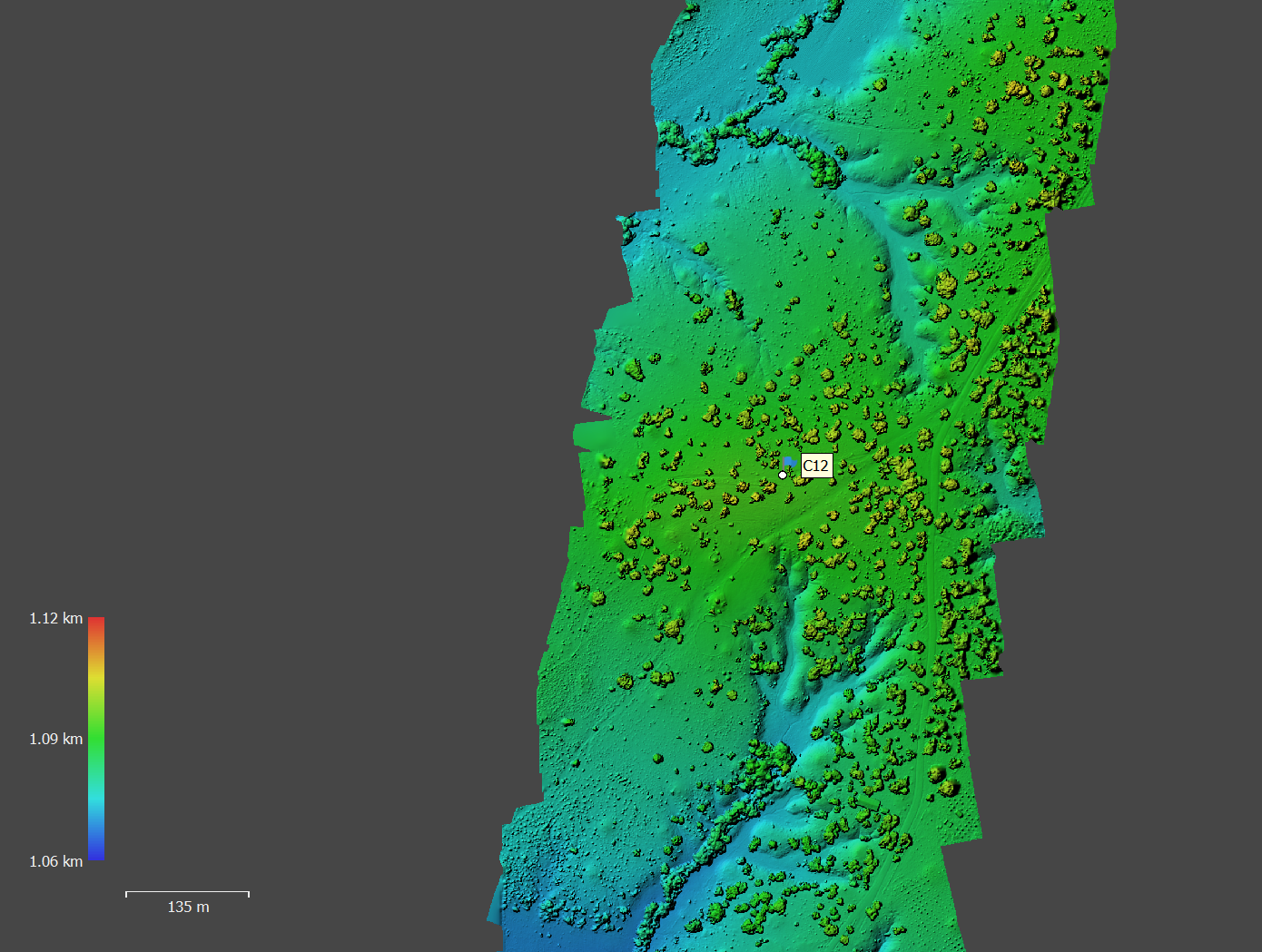
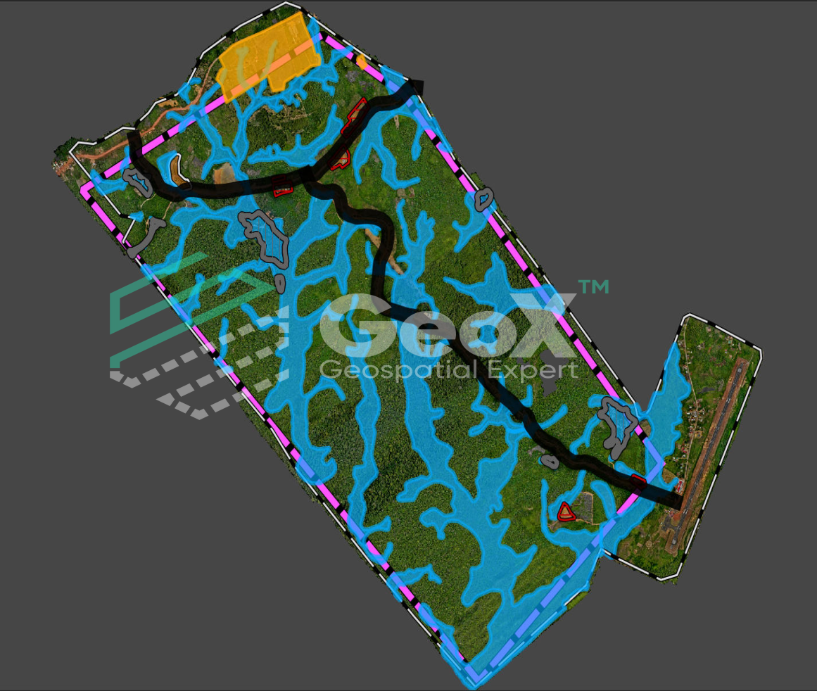
KANANGA URBAN EMEERGENCY AND RESILIENCE PROJECT
LiDAR AND PHOTOGRAMMETRIC STUDIES OF EROSION SITE Client: PURUK Financing : WORLD BANK
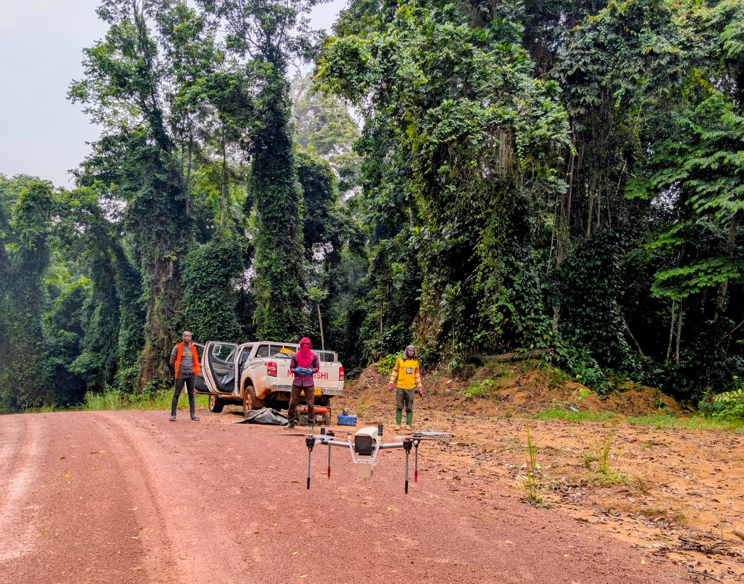 ⛏️ Mining & Quarry Operations
GRAVEL QUARRY STUDIES
LiDAR AND PHOTOGRAMMETRIC STUDIES OF 1500Ha SURFACE IN FOREST Client: EECSG Financing: PORTEO BTP
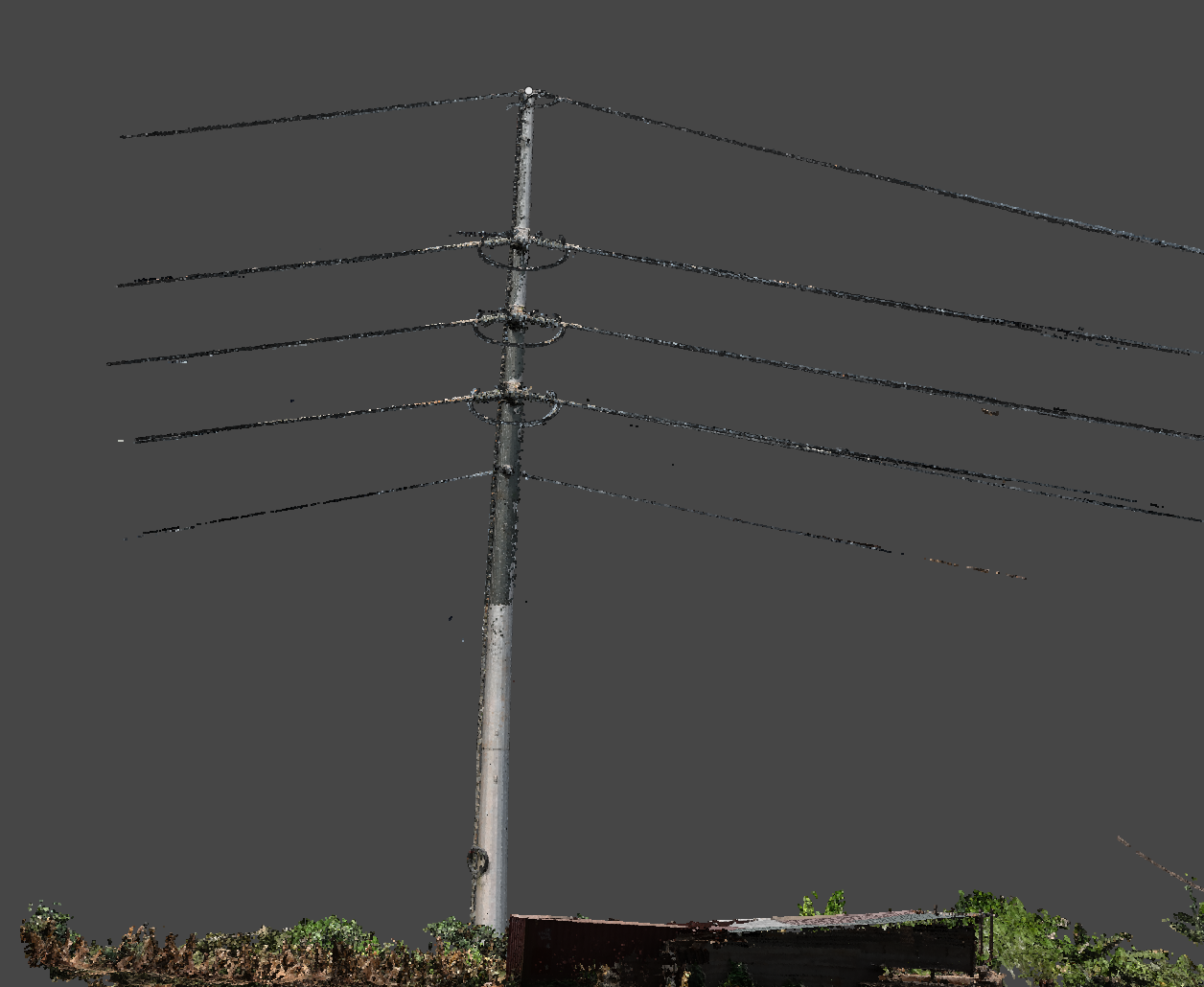 ⚡ High voltage / electricity / power line
POWER LINE MONITORING
Aucun projet trouvé
Essayez une autre catégorie